There is a Web site that has City of Austin planning maps available for download. The main table of contents is at this UT site, and the City of Austin files are here.
The information is very self-explanatory, including how to get a viewer program. However, the files are very large and you certainly don't want to download them unless you're on Roadrunner or DSL. If you want some simple question answered from this data, give a call to Ron Clark.
DO NOT use any of this information for anything other than general background information. We do not know how often the files on the above Web site are updated, and the maps below were created from the data available in these files in June, 2000. If you need up-to-date, accurate, or official information, contact the City of Austin, or an attorney, engineer, or other appropriate professional.
Summary:
Jurisdictional
boundary lines:
Bunny Run: North
half South
half
ACPNA (West side Lake Austin) North
part Middle
part South
part
Subdivision boundaries
North
portion Bunny Run Middle
portion Bunny Run South
portion Bunny Run
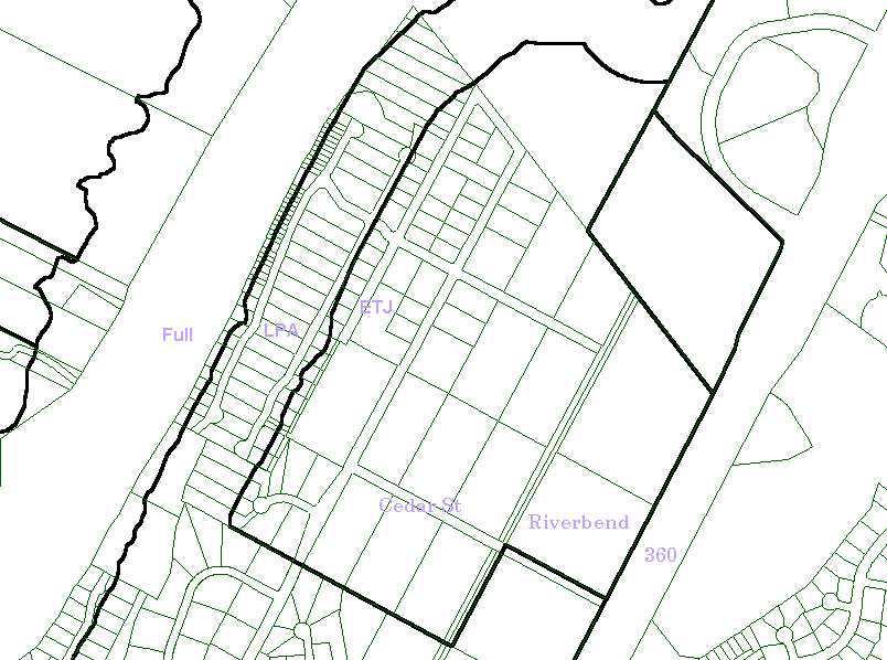
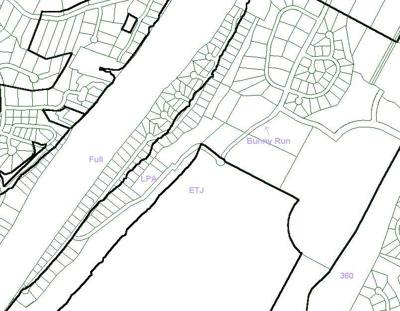
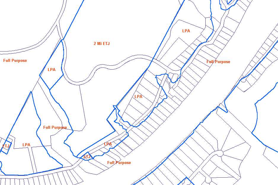
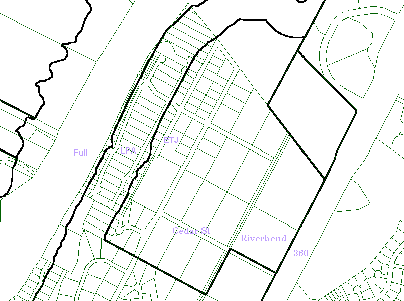
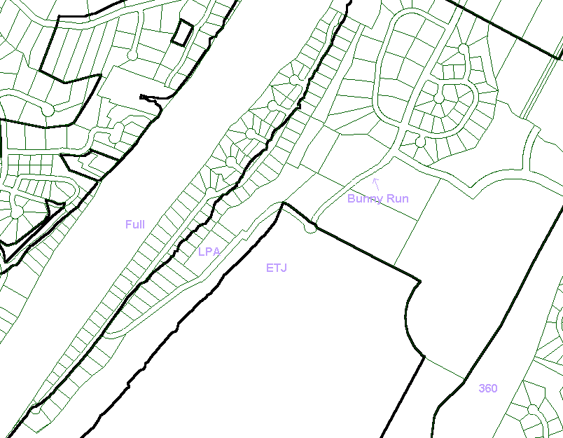
I have created two small images from the (very large) City map files.
On these pictures, you can hopefully figure out the street and lots that
interest you. The jurisdiction boundary lines are black lines, and I have
added the letters "Full" (for "Full Purpose" Annexation), "LPA" (for "Limited
Purpose" Annexation), and "ETJ" (for "Extra Territorial Jurisdiction")
to the map to indicate which area is which. This is an unofficial modification,
but based on information available when I look at the full map file from
the City.
Note: there are apparently two sub-classifications of
"Limited Purpose" annexation - but these are not distinguished on these
map files. If it matters to you, you would need to contact the City
of Austin. One sub-classification is "pz", for 'planning & zoning';
the other is "pzhs", for ' planning & zoning, health & safety'.
"ETJ" also has sub-classifications; the Bunny Run area is within what is
called "2 Mile ETJ".
Note that many lots are cut through by these boundary lines. If you need to know the exact jurisdictions under which a specific lot falls, you should contact the City of Austin. The Bunny Run Neighborhood Association president has acquired such information in the past and can help point you toward the right contacts.
I used the base map and the jurisdictional boundaries overlay from the Web site listed above to create these map images:
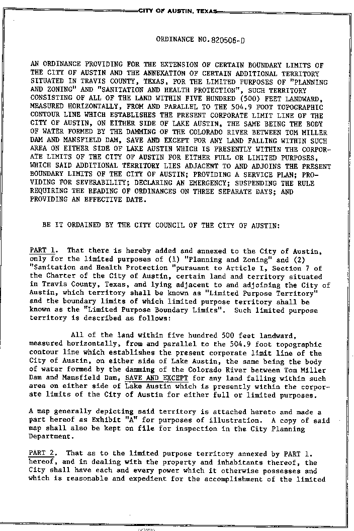
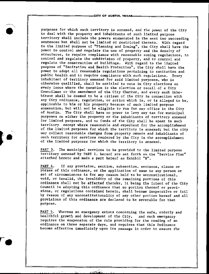
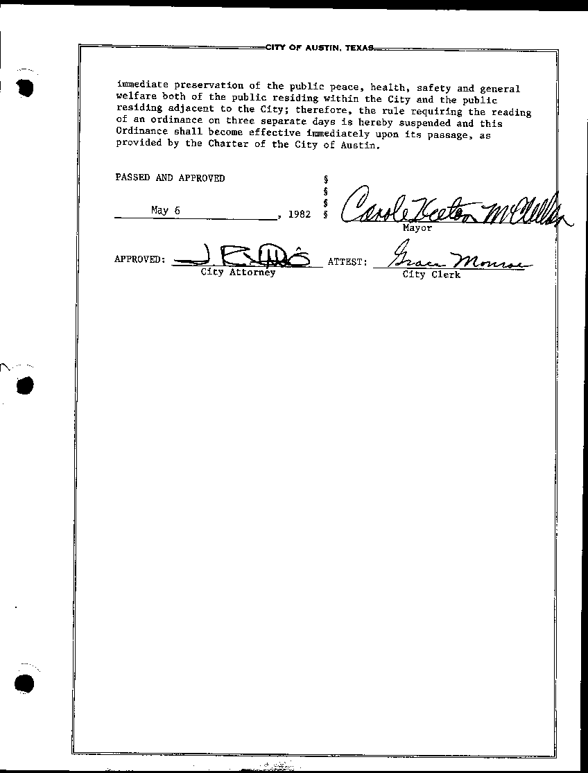
Of historical interest, here is a 5-page document, a copy of the ordinance that created Limited Purpose Annexation in 1982.
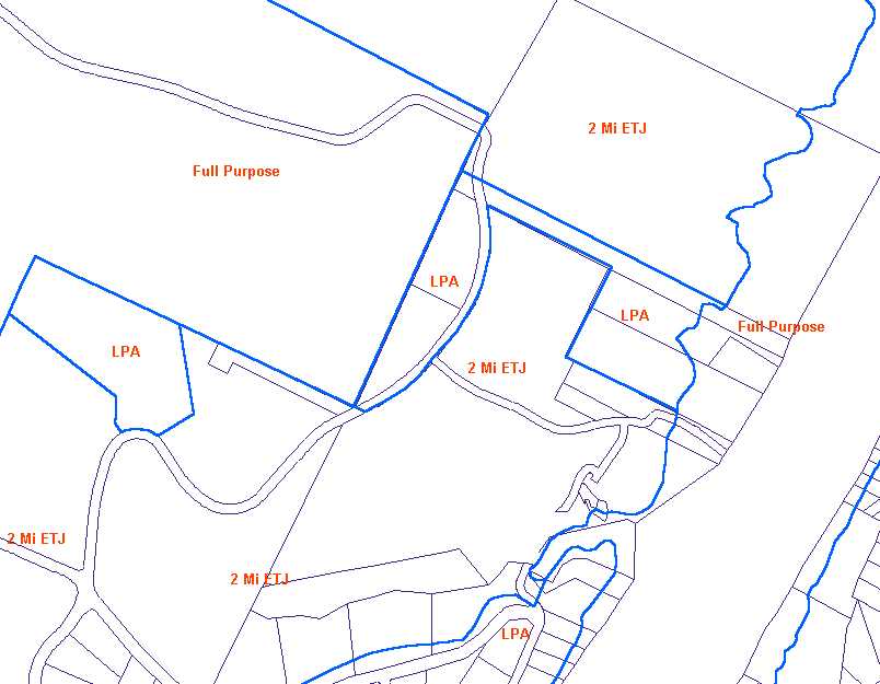
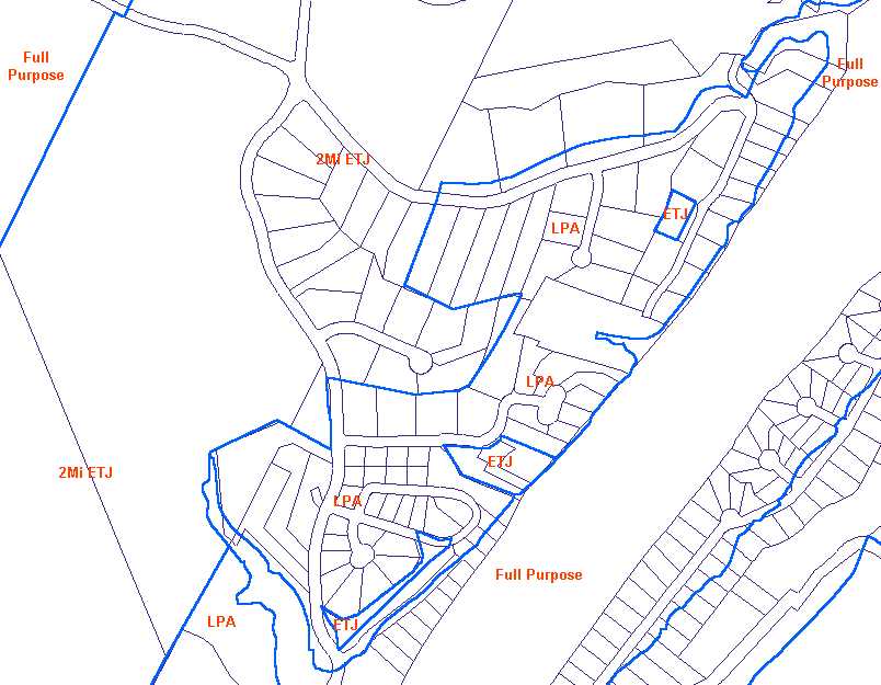
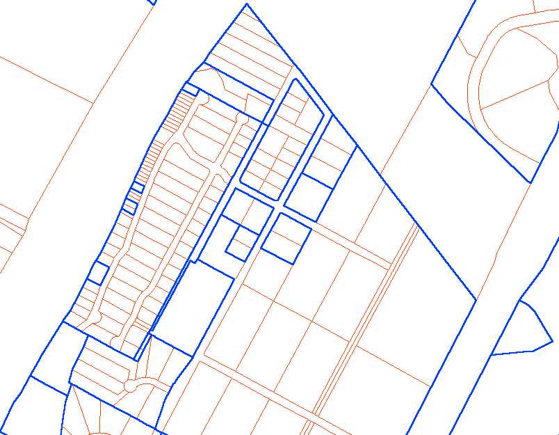
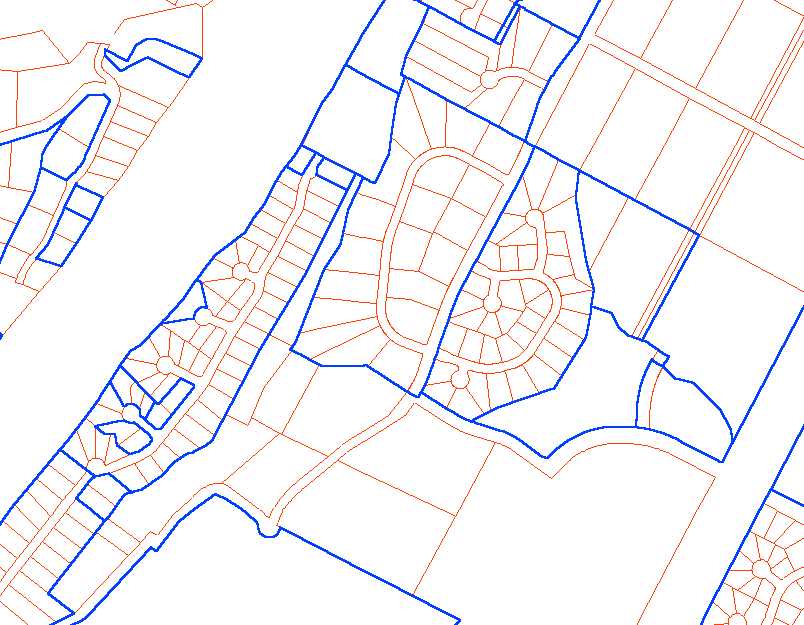
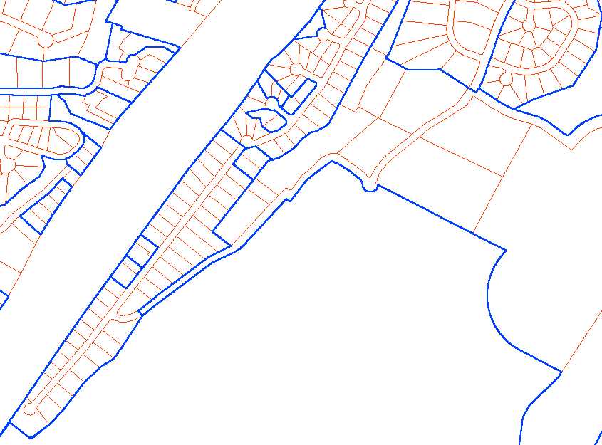
I have created three small images from the City map files. On these pictures, you can hopefully figure out the street and lots that interest you. Detailed information about subdivisions is not available on these maps, so I cannot label them, explain them, or add any more. They are For Your Information - if they raise questions, please consult with an attorney or other appropriate professional.
I used the base map and the "subdivisions" overlay from the Web site listed above to create these map images:
The Austin City Park Neighborhood Association is on the West side of Lake Austin, across from Bunny Run. I have created three small images from the (very large) City map files. On these pictures, you can hopefully figure out the street and lots that interest you. The jurisdiction boundary lines are black lines, and I have added the letters "Full", "LPA", and "ETJ" to the map to indicate which area is which. This is an unofficial modification, but based on information available when I look at the full map file from the City.
| Updated: July 2, 2000 |
|
Back to Bunny Run Main Site |